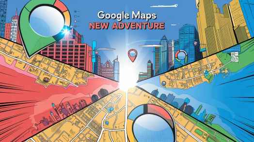
Introduction
Do you know, in a world where tech leads our every step, Google Maps is doing more than just guiding us from point A to point B. It’s breaking new ground in digital navigation. But wait, there’s more! Beyond just directions, Google Maps is turning into a super cool tool for discovering history and learning about our planet.
Imagine this: you can explore your neighborhood as it looked 50 years ago or even take a virtual tour of faraway places you’ve never seen before. The latest updates to Google Maps are not only changing the way we get around but also letting us travel through time and space in very cool ways. Let’s dive in and see how these updates are shaping the future of maps and exploration.
A Time Machine Right in Your Hands
Hey, ever tried Google Maps latest cool trick? They call it the “Time Machine”. Super exciting, right?
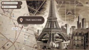
Imagine this: you’re standing at a famous spot, and with just a click, you can jump back to see it as it was in the 1930s or 1950s. This nifty tool lets you see how places have changed over the past 80 years. Talk about a blast from the past!
So whether you’re into history or just wondering how your town used to look, Google’s got you covered. Their vast archive of old satellite and aerial photos means anyone can take a peek at different times. It’s not just for big cities like New York or Tokyo. You can check out all sorts of places around the globe! Maybe you’ll see how suburbs popped up or track changes in forests far away. Imagine what researchers, city planners, and history buffs can do with this! Google Maps isn’t just for getting from point A to point B anymore; it’s like a window to the past we’ve all shared.
Street View Expands to New Places
Ever since it started, Street View has let folks explore landmarks, streets and cities all around the world. Now the latest update has expanded Street View to nearly 80 countries. You can now check out places like Bosnia, Namibia, and Paraguay! This is HUGE for virtual travelers because now you can explore more places from your cozy living room.
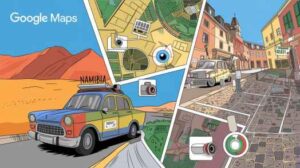
The new camera technology? It makes everything look even better. The images are sharper and more colorful than before. So, whether you want to see the sandy dunes in Namibia or old cobbled streets in Europe, you’ll get a clear and rich virtual experience. This update isn’t just for people exploring for fun; urban planners and researchers can use these sharp pictures too. They can study cities and see how they’re growing and changing.
So go ahead, take a virtual trip!
Sharper Imagery: AI-Powered Enhancements
Google Maps isn’t just getting bigger; it’s making what we see way better. With these cool AI tweaks, Google Maps and Google Earth now show more colorful and crystal-clear views of our planet than ever before. Google’s Cloud Score+ AI model steps in to clear out annoying stuff like clouds, haze, and mist that hide satellite and aerial pictures.
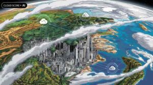
So, when you zoom in on the thick Amazon rainforest or check out a bustling city, everything looks much sharper and more detailed. For folks like environmental researchers and urban planners, this is huge. Clearer images help them keep an eye on things like land use changes, deforestation, and even climate shifts better. With this new AI tech, Google Maps is changing how we see our world for real.
Virtual Reality & Augmented Reality: A New Dimension in Street View
The lines between the virtual world and the real one are fading, and Google Maps is leading this exciting change. With Street View’s latest tweak, AR (Augmented Reality) and VR (Virtual Reality) tech is totally mixed in. Now, users get to explore in a whole new way—not just on flat screens but with super cool 3D experiences.
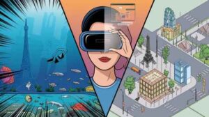
Imagine this: putting on a VR headset and taking a dive deep into the Great Barrier Reef or strolling through Paris streets, all while sitting at home. Whether you love traveling or you’re a teacher wanting to take kids on virtual trips, the possibilities are endless.
For schools and folks alike, the new AR and VR features in Google Maps bring an unmatched level of fun and realness.
Custom Map Creation: A Researcher’s Dream
You know what’s really cool? Google lets you make your own maps now. This is a game-changer, especially for environmental researchers, historians, and organizations. They can show off their findings in a whole new way. Imagine seeing urbanization, climate change, or natural disasters right there on a map you made yourself.
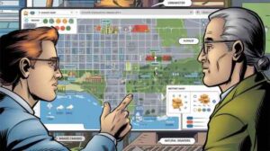
Custom maps don’t just look cool; they help people work together too. Teams can share what they’ve done with others easily. It’s like opening the doors wide for everyone to see. And guess what? Teachers and researchers can use these maps to create fun, interactive lessons about geography, city life, or nature.
With these awesome features, Google Maps isn’t just about looking at the world anymore. It’s about understanding it and helping others do the same. So, go ahead—explore, create, and share!
Navigating the Future with Google Maps
Google Maps is always changing, getting better, and adding new stuff. Recent updates show it’s becoming more personal and useful for everyone. Lately, Google has included EV charging station finders, metro ticket bookings, and real-time wildfire alerts. These are super handy. Especially in places like India, where cities are growing fast and there are lots of environmental issues.
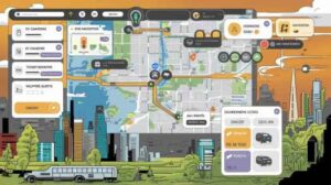
Using AI, old pictures, and live navigation together makes Google Maps a must-have tool. Not just for daily use but also for learning and studies. If you need to find your way around town or you’re tracking city growth and environmental changes, Google Maps offers details and features that are hard to beat.
It’s great for casual users, professionals, and everyone in between.
Conclusion
The most recent updates to Google Maps signal a fresh era of exploration and discovery. Whether it’s using the “Time Machine” option to explore historical images or leveraging AI to enhance visuals, Google keeps pushing the boundaries of digital maps. With AR/VR features added and tools for creating custom maps, the possibilities are endless. This makes Google Maps a top choice for travelers, researchers, and curious folk alike.
Read Also: Meta AI on WhatsApp: Revolutionizing User Interaction with Real-Time Conversations & Photo Editing
FAQs
1. What is the Time Machine feature on Google Maps?
So, the Time Machine feature is super cool. It lets you check out old images of places, going back up to 80 years! You get to see how cities, towns, and nature looked before.
2. How has Street View improved in Google Maps?
Street View is now way better. It’s in almost 80 countries with even sharper and more detailed pictures. You can explore new places like you’re really there, seeing everything clear as day.
3. What role does AI play in the latest Google Maps updates?
AI’s got a big job here. It makes satellite and aerial pictures clearer by removing things like clouds and haze. So, the images you see are super sharp and accurate.
4. Can I create custom maps on Google Earth?
Absolutely! Google Earth now lets you make and share your own maps. It’s a great tool for teachers, researchers, and groups to show their projects.
5. How do the AR/VR integrations enhance Google Maps?
With AR/VR, you can go on adventures in 3D spaces. It’s like being there in person, giving you a fun and realistic virtual trip.